May 2025
-
Woolpert Acquires Bluesky International, UK’s Largest Commercial Aerial Survey Firm
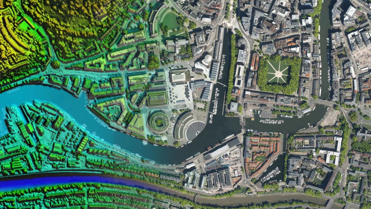
Woolpert has acquired Bluesky International, the largest aerial survey firm in the United Kingdom and the U.K. government’s supplier of choice for aerial photography and height data. The private, multidisciplinary…
Read More
November 2023
-
Bluesky Geospatial Launches MetroVista 3D Aerial Mapping Program in US
Bluesky Geospatial Ltd. has announced the launch of its MetroVista 3D aerial mapping program in the United States. The service employs a hybrid imaging-LiDAR airborne sensor to capture highly detailed…
Read More
July 2023
-
Bluesky International Aerial Data Helps Pinpoint Natural Hazards At UK Development Sites
A geotechnical and consultancy agency is using geospatial data to work smarter, saving significant time and money, both for themselves and their clients. Card Geotechnics Ltd (CGL) is applying aerial…
Read More -
Bluesky International’s Airborne Sensors Help Developers Protect Wildlife Habitats
Multi-spectral imagery from Bluesky International is helping developers contribute to government targets to protect and conserve wildlife habitats in the UK. Using the latest Artificial Intelligence (AI) technology, in combination…
Read More -
Bluesky International Building Models Aid Planning For World’s Largest Cultural Hub
3D building models from aerial mapping company Bluesky International, are at the heart of plans for a landmark development in the centre of Coventry, informing Virtual Reality (VR) presentations and…
Read More
April 2023
-
Bluesky International And Ecopia Partner To Create First 3D Map Of Ireland
Bluesky International and Ecopia AI (Ecopia) have announced a partnership to develop the first ever 3D land cover map of Ireland. Generated using Bluesky’s 12.5 and 25 cm resolution aerial imagery and…
Read More -
Bluesky International Partners With UP42 To Supply Aerial Imagery And Geospatial Data
Bluesky International announces a new partnership with Berlin-based UP42, a leading geospatial developer platform and marketplace. The recently signed agreement will see Bluesky supply its accurate, high resolution aerial imagery…
Read More
March 2023
-
Bluesky International Partners With SkyFi To Widen Access To Aerial Imagery
Bluesky International announces a new partnership with SkyFi, an American company, based in Texas, that aims to democratise access to earth observation assets by providing access of multi-perspective imagery to…
Read More
November 2022
-
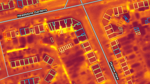
Night Surveys Show Heat-Loss from Homes to Help UK Councils Allocate Energy-Saving Funds
Aerial surveying company Bluesky is planning night-time flights over UK cities this winter with the latest high-tech thermal imaging camera to measure heat loss from roofs. UK local authorities are…
Read More
October 2022
-
Bluesky International announced as supplier for new Ordnance Survey framework
Bluesky International, a leading UK aerial survey and mapping company, has fought off stiff competition to be named as one the selected organisations to sit on a new framework created…
Read More
September 2022
-
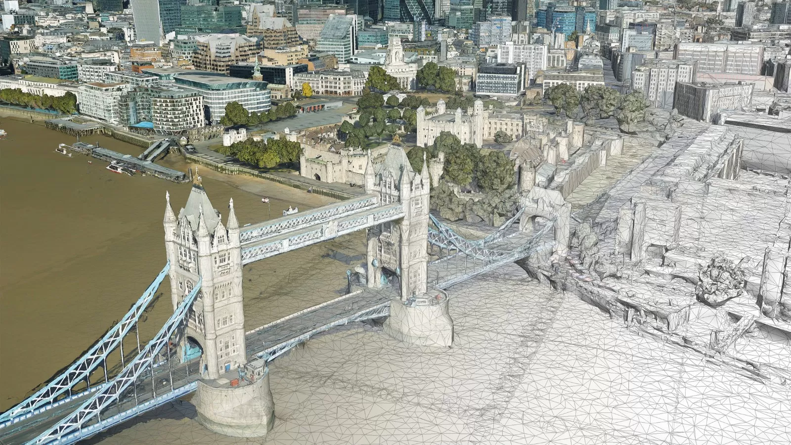
Bluesky Takes to the Skies to Capture More Oblique Views of UK Cities
Aerial mapping company Bluesky International, is using one of the world’s most advanced hybrid sensors to expand its library of high-definition oblique photographs of UK cities to reveal more detail…
Read More
August 2022
-
Bluesky International Celebrates Extension to Multi Million Pound Government Mapping Contracts
Aerial mapping company and consortium lead Bluesky International, in partnership with Getmapping plc, has been granted a contract extension from the Geospatial Commission to continue to supply aerial photography, 3D…
Read More -
Bluesky International Reveals Growing Appetite for Same Day Delivery Geospatial Data
Aerial mapping company Bluesky International, has revealed a huge upsurge in the demand for same day delivery geospatial data. Since launching its online Mapshop, companies from industries such as architecture,…
Read More
June 2022
-
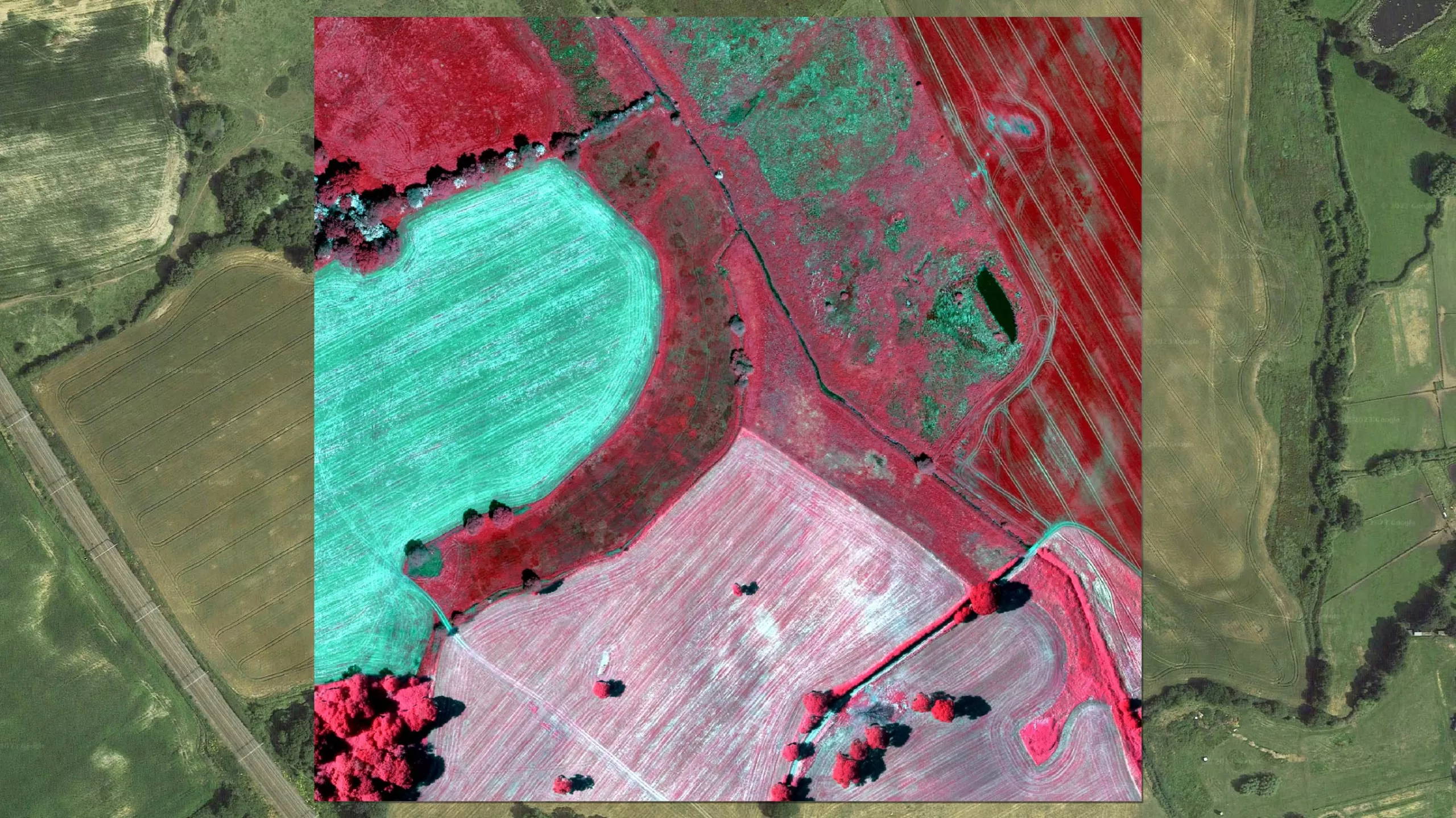
Bluesky Aerial LiDAR Survey Data Helps UK Farmers Apply for Carbon Credits
A new government funded project is using LiDAR data captured by aerial survey and mapping company, Bluesky International to identify areas of hedgerow and subsequently the amount of carbon captured…
Read More -
Bluesky LiDAR and Aerial Photography Bring Builds to Life for Dublin Design Studio
A Dublin based architectural consultancy is using data from aerial survey and mapping company Bluesky International to ensure the planning process is conducted as efficiently and smoothly as possible for…
Read More
April 2022
-
Bluesky International get excited for the new 2022 Flying Season across the UK
Bluesky International, the UK’s leading aerial mapping company, is preparing for the start of the 2022 flying season. Following a productive 2021 season across the United Kingdom and Republic of…
Read More
March 2022
-
Bluesky 3D Models Help Macro Works Plan Milestone Solar Farm in Ireland
3D maps derived from the latest aerial photography are being used to secure planning permission for solar farms across the Republic of Ireland. Created by Bluesky International, the Digital Terrain…
Read More -
Bluesky Adds Scottish Cities to MetroVista 3D City Line-up
Aerial mapping company Bluesky International has added Edinburgh and Glasgow to its growing coverage of MetroVista 3D city models. Acquired using a state-of-the-art aerial sensor that simultaneously captures vertical and…
Read More
February 2022
-
Bluesky Aerial Photography Helps UK Homes Boost Solar Energy Output and Reduce Carbon Emissions
Aerial mapping company Bluesky is helping Derby Homes roll out integrated solar photovoltaic (PV) systems across its housing stock. A project to identify suitable roof coverings assessed more than 8,000…
Read More
January 2022
-
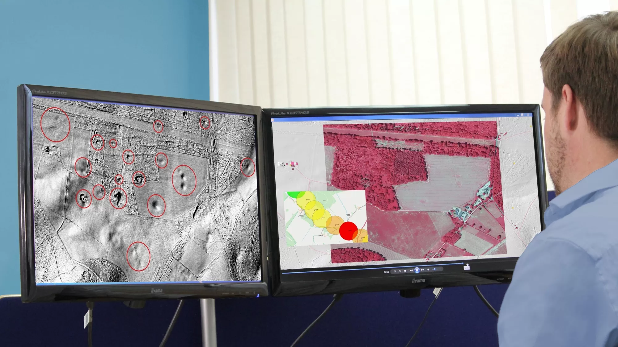
Bluesky International LiDAR Survey Reveals More than 400 ‘New’ Archaeological Sites in AONB
A high precision terrain mapping project has revealed more than 400 ‘new’ archaeological sites in England’s first Area of Outstanding Natural Beauty (AONB). Commissioned by the Quantock Landscape Partnership Scheme…
Read More
December 2021
-
Bluesky Aerial Photography used to Map Green Roofs in UK
Bluesky International Ltd, the UK’s leading aerial survey and mapping company, has supplied its high-resolution photography to support a new artificial intelligence platform created by technology start-up Gentian. The platform…
Read More
October 2021
-
Hexagon Streams Bluesky GB Aerial Photography via HxGN Content Program
A partnership between Bluesky International and Hexagon’s Geosystems division will see the most up-to-date aerial imagery of England, Scotland and Wales added to the largest, online library of orthophotography for…
Read More -
Bluesky LiDAR Benchmarks Carbon Neutral Farming in Northern Ireland
A European Innovation Partnership project to accelerate the move towards net carbon zero farming is using specially commissioned LiDAR data to create a baseline for future measurements. Working with ARCZero…
Read More
September 2021
-
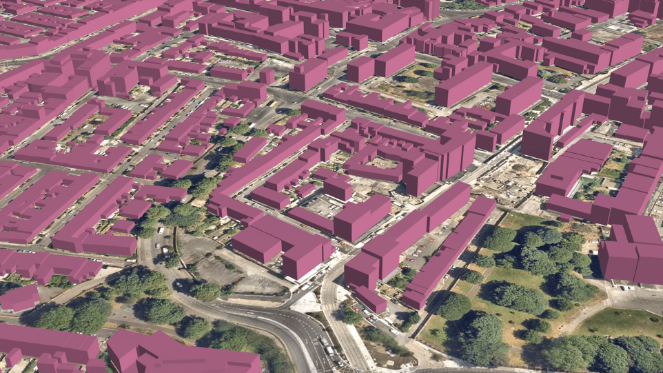
Bluesky and University of Leicester Use AI to Reduce Data Intensity for Smart City Applications
Aerial mapping company Bluesky International and the University of Leicester are using Artificial Intelligence and Machine Learning to make 3D models easier to use in smart city and digital twin…
Read More -
Bluesky Aerial Photomaps Feature in International Arts Festival
Mirror Pavilion, Leaf Work, (Derrigimlagh) 2020 by John Gerrard photo by Ros Kavanagh Aerial photography and 3D height models from Bluesky are informing a new art installation in Ireland. Part…
Read More
August 2021
-
Bluesky Cyclomedia Partnership Combines Aerial and Mobile Mapped Data for Virtual City Models in UK
Aerial mapping company Bluesky International is working with the Dutch mobile mapping specialist Cyclomedia to bring together imagery and height data, captured from the air and at street level, to…
Read More
July 2021
-
Bluesky and BlackSky Join Forces to Bring Satellite Imagery to the UK
Bluesky International (Bluesky), the leading aerial survey company in the U.K. and Republic of Ireland, announced it has joined BlackSky’s Global Reseller Program. BlackSky is a leading technology platform providing…
Read More
June 2021
-
Bluesky MetroVista Models Transform Real Estate Marketing with 3D Visualizations
Photorealistic 3D models from aerial mapping specialist Bluesky are being used to create real-world interactive visualizations to transform how unbuilt commercial and residential property is presented for sale. Created by…
Read More -
Boston University Uses Bluesky Aerial Photomaps to Research Climate Change
Researchers at Boston University are using high resolution aerial photography to investigate how important coastal ecosystems are responding to climate change. The study focused on an area of salt marsh…
Read More -
Aerial Mapping Company Bluesky International Sets Out Plans for 2021 Flying Season
Bluesky International has made a flying start to its nationwide aerial survey update programme. Having capitalised on the continued low levels of air traffic and good weather in April, Bluesky…
Read More
May 2021
-
Bluesky 5cm Aerial Photography Reveals Hidden Parts of London
Southwark Council is using the highest resolution photography from Bluesky to inform frontline service provision and decision making across its planning, transport, housing and environment operations. The 5cm data offers…
Read More -
Bluesky Aerial Maps Light the Way for Contaminated Site Investigation and Clean Up
Aerial mapping company Bluesky has completed a topographic survey of the old Anchor Color and Gum Works site in Dighton, Massachusetts. Working with Lighthouse Land Surveying, LLC and under strict…
Read More -
Bluesky International 3D Building Models Strengthen BIM Workflows for Buttress Architects
Design studio Buttress is using 3D building models from Bluesky to create interactive walkthroughs and Virtual Reality (VR) presentations as part of its Building Information Modelling (BIM) workflow. Created from…
Read More
April 2021
-
Architect Brings Design to Life with Virtual Reality Using 3D Building Models
Architects Kirkland Fraser Moor (KFM) are pioneering the use of Virtual Reality (VR) to bring to life design processes and stakeholder consultations. Using VR based on a 3D building model…
Read More -
Bluesky MetroVista Mesh Models Underpin Dynamic Map of London
Photorealistic 3D models from Bluesky are being used to produce a new interactive map of London. Created by the Centre for Advanced Spatial Analysis (CASA), part of the Bartlett Faculty…
Read More
March 2021
-
Bluesky Addresses Urgent Need for 3D Mapping Data with Sensor Investment
Aerial mapping company Bluesky International has secured its position as the leading UK provider of 3D mapping data following the purchase of the very latest high performance aerial mapping sensor…
Read More -
Bluesky International 3D Building Models Bring Architectural Studies Online During Lockdown
Liverpool School of Architecture is using 3D building models, derived from the latest aerial photography, to help teach students online during the pandemic lockdown. Created by aerial mapping company Bluesky,…
Read More
February 2021
-
Newcastle University Pioneers Hyper-Resolution Flood Risk Modelling using Bluesky MetroVista Data
Newcastle University is developing advanced computer modelling to assess the flood risk of individual properties using LiDAR data and oblique aerial photography from Bluesky. The project will use Artificial Intelligence…
Read More -
Bluesky 3D Building Models Drive Efficiency and Collaboration in Water Construction in the UK
Water sector solution provider MWH Treatment is using the latest 3D computer modelling technology to improve the delivery of major construction projects across the UK. Created by aerial mapping company…
Read More -
Bluesky International Takes to the Air to Create First Ever 3D Map of Northern Ireland’s Coastline
Bluesky International will use aircraft mounted LiDAR sensors laser scanners to create a highly detailed 3D map of the whole of the Northern Ireland coastline. Working on behalf of the…
Read More
January 2021
-
Bluesky International LiDAR Used to Visualise Peatland Restoration on Royal Estate
Data collected from survey aircraft equipped with advanced laser scanners is being used by the James Hutton Institute to monitor the natural restoration of land at the Queen’s Balmoral Estate…
Read More