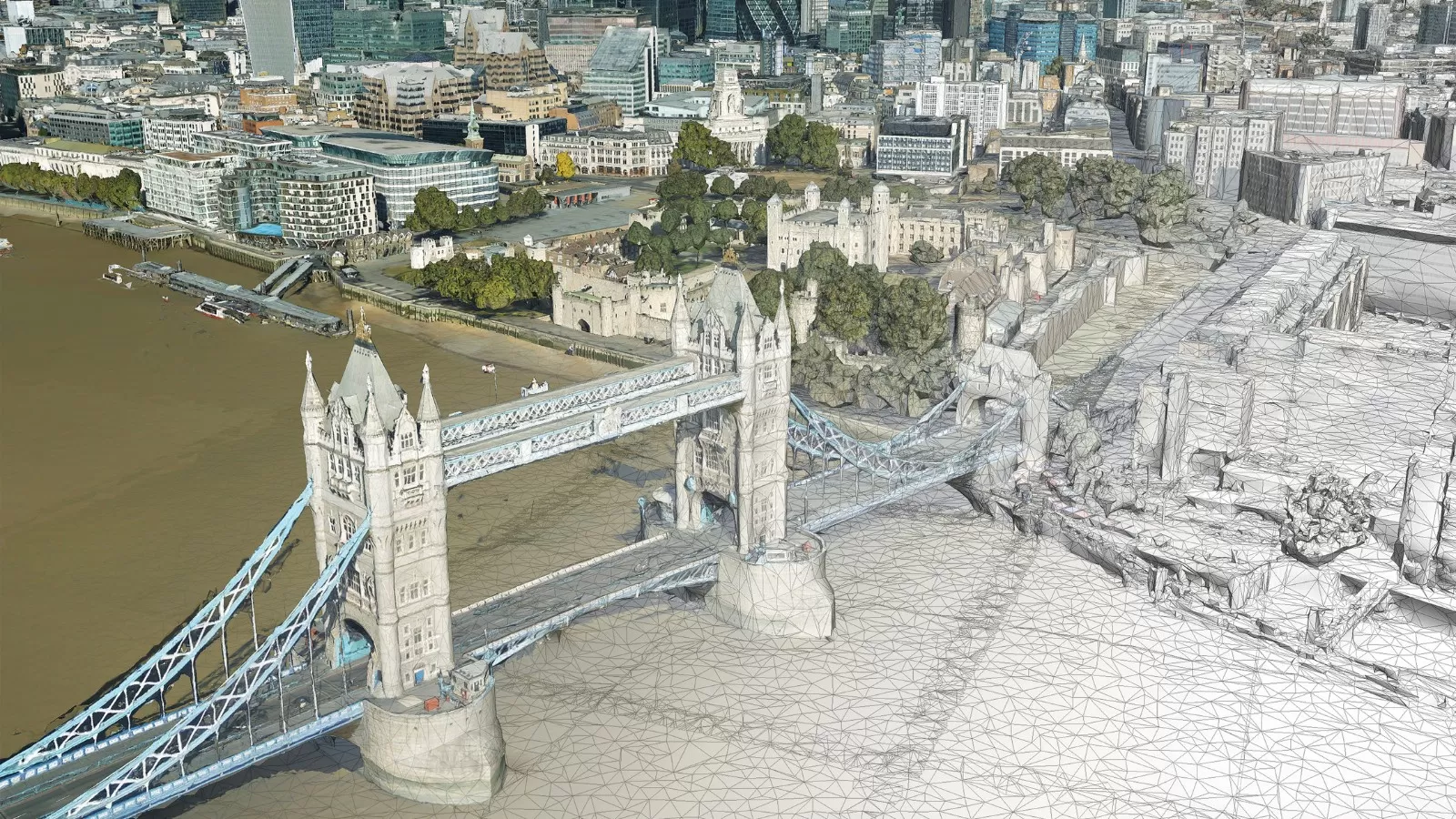
Topographic Mapping
Bluesky provides several mapping and imagery products ranging from standard topographical mapping to terrain models, orthophotos, volumetrics, and aeronautical mapping and obstacle analysis.
From simple woodlots or stockpiles to complex transportation corridors and aeronautical mapping and analysis, Bluesky has a cost-effective mapping solution.
Topographic mapping and GIS in particular, play a vital role in the decision-making processes in an ever increasing sphere of areas as diverse as transportation, urban planning, environment, resource management and health. The users of topographic and GIS data are just as diverse as its many uses, including local and national government, emergency services, security, military, agriculture, forestry, utilities, and telecommunications.
Products can range from topographic CAD drawings to richly attributed geodatabases populated with TINs, rasters and vector data with topological rules enforcing data integrity allowing for numerous complex analysis to be performed, producing outputs to help solve diverse geospatial queries.
Projects can be delivered in several formats from AutoCAD (DWG) to the latest version of Civil 3D and specialist GIS formats. We can utilize your specific CAD template and build civil surfaces, streamlining your workflow. Other formats include LandXML, SHP, SDF, DGN & DXF.
Here at Bluesky we have an expert, in-house team of experienced photogrammetrists enabling us to create accurate datasets from detailed specifications by applying our up-to-date high resolution aerial photography. Photography can be flown to client specification.
Our services include:
Topographic Mapping
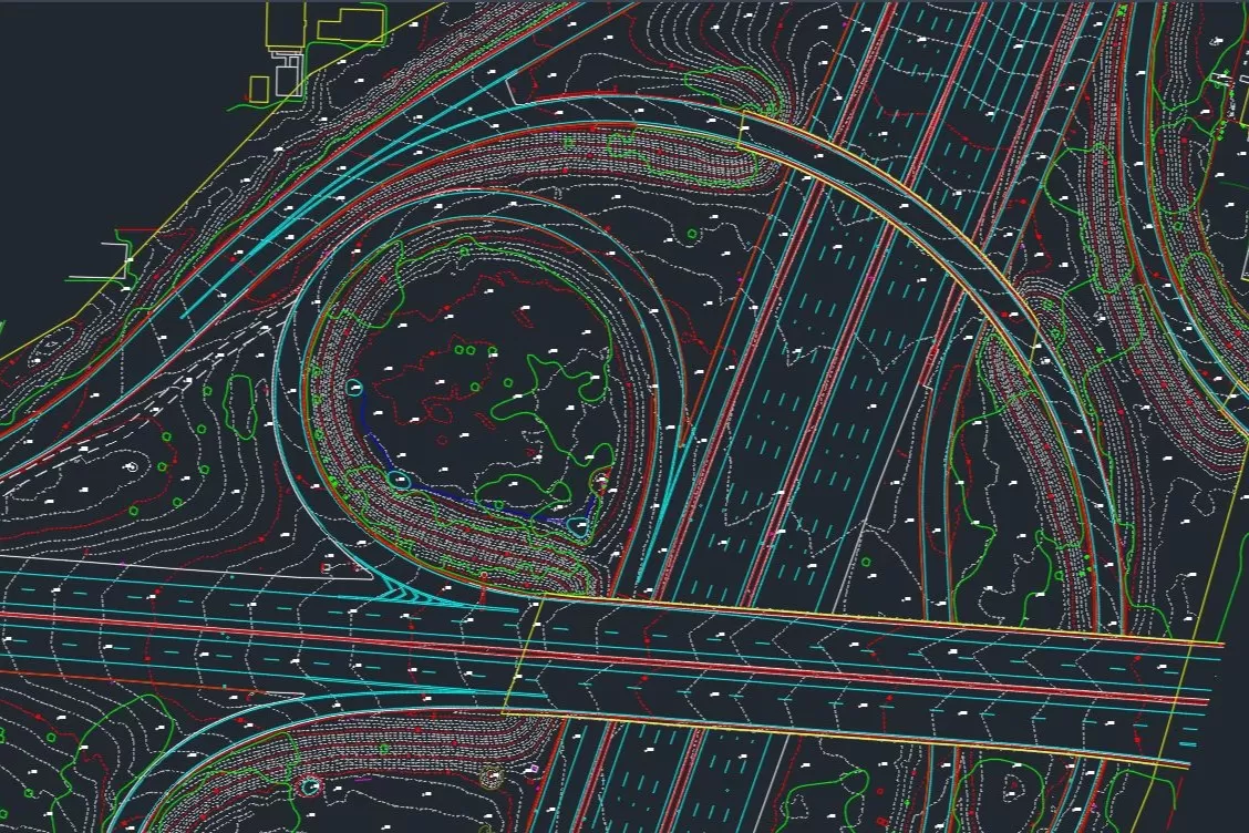
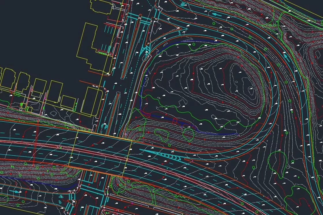
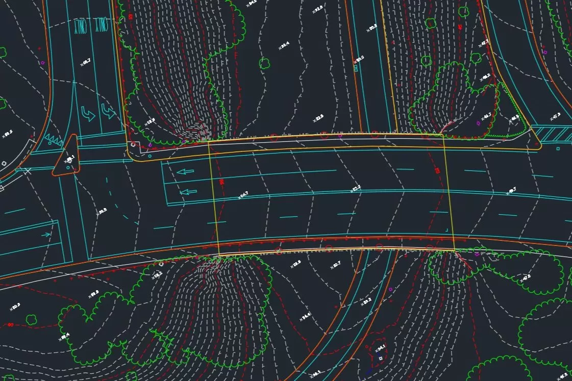
Applying high resolution stereo aerial photography, we produce topographic mapping to a scale and specification commensurate with your project requirements. We can undertake updates to your in-house topographic maps commensurate with regional DOT standards, or create high detail mapping up to 1″ = 20′ scale for engineering and infrastructure projects.
Utilities and Asset Mapping
Accurate mapping of our utility networks is critical. Using a combination of aerial photography and LiDAR we create accurate maps identifying and locating important electricity, water and gas assets. We can work to tailored specifications.
Land Use Mapping
Using aerial photography and Color Infrared (CIR) imagery, which can be captured to order, we undertake detailed analysis to identify specific land use and levels of land cover. Extracted information is provided as GIS ready layer, and mapped to client specification.
Topographic Mapping Examples