November 2023

  • Bluesky Geospatial Launches MetroVista 3D Aerial Mapping Program in US

    Bluesky Geospatial Ltd. has announced the launch of its MetroVista 3D aerial mapping program in the United States. The service employs a hybrid imaging-LiDAR airborne sensor to capture highly detailed…

    Read More

July 2023

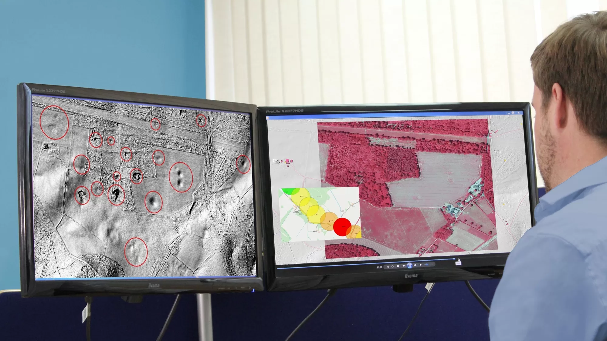
  • Bluesky International Aerial Data Helps Pinpoint Natural Hazards At UK Development Sites

    A geotechnical and consultancy agency is using geospatial data to work smarter, saving significant time and money, both for themselves and their clients. Card Geotechnics Ltd (CGL) is applying aerial…

    Read More
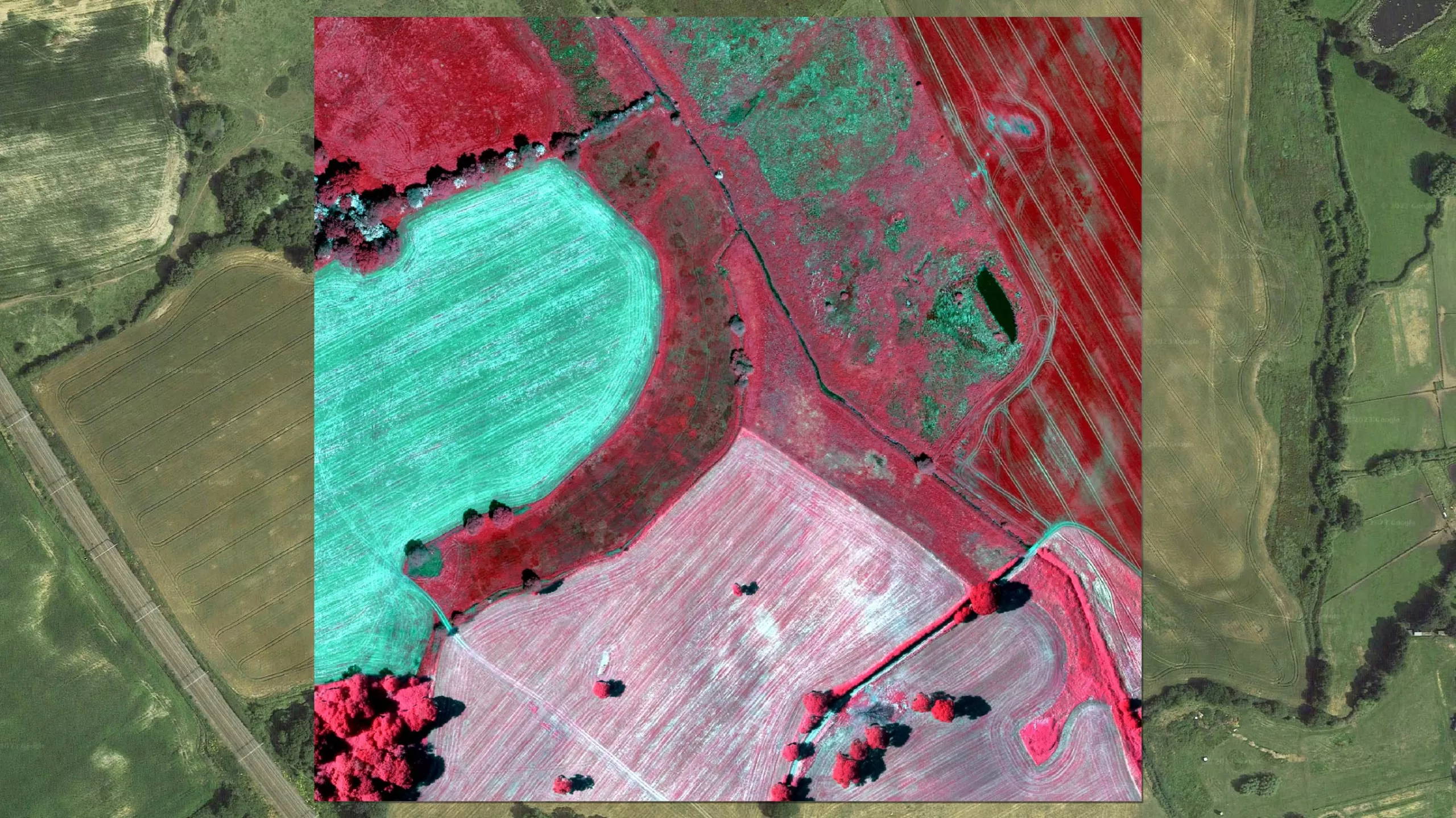
  • Bluesky International’s Airborne Sensors Help Developers Protect Wildlife Habitats

    Multi-spectral imagery from Bluesky International is helping developers contribute to government targets to protect and conserve wildlife habitats in the UK. Using the latest Artificial Intelligence (AI) technology, in combination…

    Read More
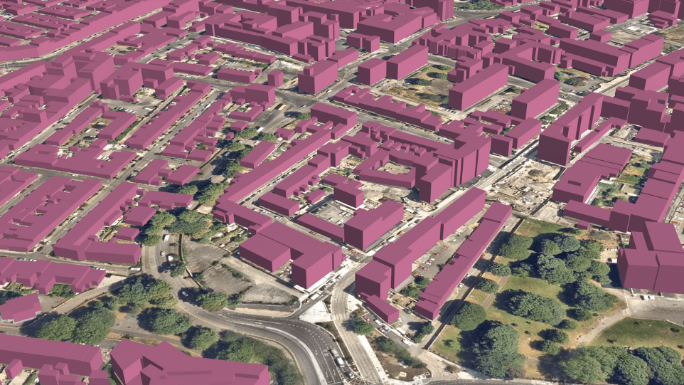
  • Bluesky International Building Models Aid Planning For World’s Largest Cultural Hub

    3D building models from aerial mapping company Bluesky International, are at the heart of plans for a landmark development in the centre of Coventry, informing Virtual Reality (VR) presentations and…

    Read More

April 2023

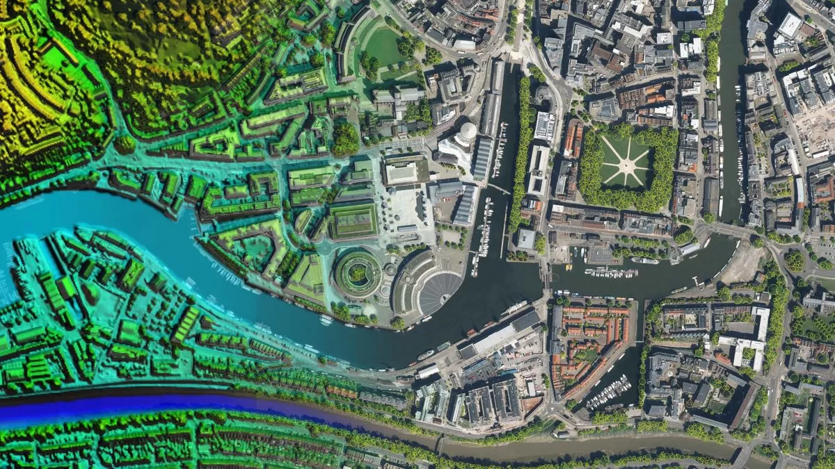
  • Bluesky International And Ecopia Partner To Create First 3D Map Of Ireland

    Bluesky International and Ecopia AI (Ecopia) have announced a partnership to develop the first ever 3D land cover map of Ireland. Generated using Bluesky’s 12.5 and 25 cm resolution aerial imagery and…

    Read More
  • Bluesky International Partners With UP42 To Supply Aerial Imagery And Geospatial Data

    Bluesky International announces a new partnership with Berlin-based UP42, a leading geospatial developer platform and marketplace. The recently signed agreement will see Bluesky supply its accurate, high resolution aerial imagery…

    Read More

March 2023

  • Bluesky International Partners With SkyFi To Widen Access To Aerial Imagery

    Bluesky International announces a new partnership with SkyFi, an American company, based in Texas, that aims to democratise access to earth observation assets by providing access of multi-perspective imagery to…

    Read More

August 2022

  • Bluesky International Celebrates Extension to Multi Million Pound Government Mapping Contracts

    Aerial mapping company and consortium lead Bluesky International, in partnership with Getmapping plc, has been granted a contract extension from the Geospatial Commission to continue to supply aerial photography, 3D…

    Read More

June 2022

  • Bluesky LiDAR and Aerial Photography Bring Builds to Life for Dublin Design Studio

    A Dublin based architectural consultancy is using data from aerial survey and mapping company Bluesky International to ensure the planning process is conducted as efficiently and smoothly as possible for…

    Read More

February 2022

  • Bluesky Aerial Photography Helps UK Homes Boost Solar Energy Output and Reduce Carbon Emissions

    Aerial mapping company Bluesky is helping Derby Homes roll out integrated solar photovoltaic (PV) systems across its housing stock. A project to identify suitable roof coverings assessed more than 8,000…

    Read More

December 2021

  • Bluesky Aerial Photography used to Map Green Roofs in UK

    Bluesky International Ltd, the UK’s leading aerial survey and mapping company, has supplied its high-resolution photography to support a new artificial intelligence platform created by technology start-up Gentian. The platform…

    Read More

October 2021

  • Hexagon Streams Bluesky GB Aerial Photography via HxGN Content Program

    A partnership between Bluesky International and Hexagon’s Geosystems division will see the most up-to-date aerial imagery of England, Scotland and Wales added to the largest, online library of orthophotography for…

    Read More

September 2021

  • Bluesky Aerial Photomaps Feature in International Arts Festival

    Mirror Pavilion, Leaf Work, (Derrigimlagh) 2020 by John Gerrard photo by Ros Kavanagh Aerial photography and 3D height models from Bluesky are informing a new art installation in Ireland. Part…

    Read More

August 2021

  • Bluesky Cyclomedia Partnership Combines Aerial and Mobile Mapped Data for Virtual City Models in UK

    Aerial mapping company Bluesky International is working with the Dutch mobile mapping specialist Cyclomedia to bring together imagery and height data, captured from the air and at street level, to…

    Read More

June 2021

  • Boston University Uses Bluesky Aerial Photomaps to Research Climate Change

    Researchers at Boston University are using high resolution aerial photography to investigate how important coastal ecosystems are responding to climate change. The study focused on an area of salt marsh…

    Read More
  • Aerial Mapping Company Bluesky International Sets Out Plans for 2021 Flying Season

    Bluesky International has made a flying start to its nationwide aerial survey update programme. Having capitalised on the continued low levels of air traffic and good weather in April, Bluesky…

    Read More

May 2021

  • Bluesky 5cm Aerial Photography Reveals Hidden Parts of London

    Southwark Council is using the highest resolution photography from Bluesky to inform frontline service provision and decision making across its planning, transport, housing and environment operations. The 5cm data offers…

    Read More
  • Bluesky Aerial Maps Light the Way for Contaminated Site Investigation and Clean Up

    Aerial mapping company Bluesky has completed a topographic survey of the old Anchor Color and Gum Works site in Dighton, Massachusetts. Working with Lighthouse Land Surveying, LLC and under strict…

    Read More