June 2022
-
Bluesky Aerial LiDAR Survey Data Helps UK Farmers Apply for Carbon Credits
A new government funded project is using LiDAR data captured by aerial survey and mapping company, Bluesky International to identify areas of hedgerow and subsequently the amount of carbon captured…
Read More -
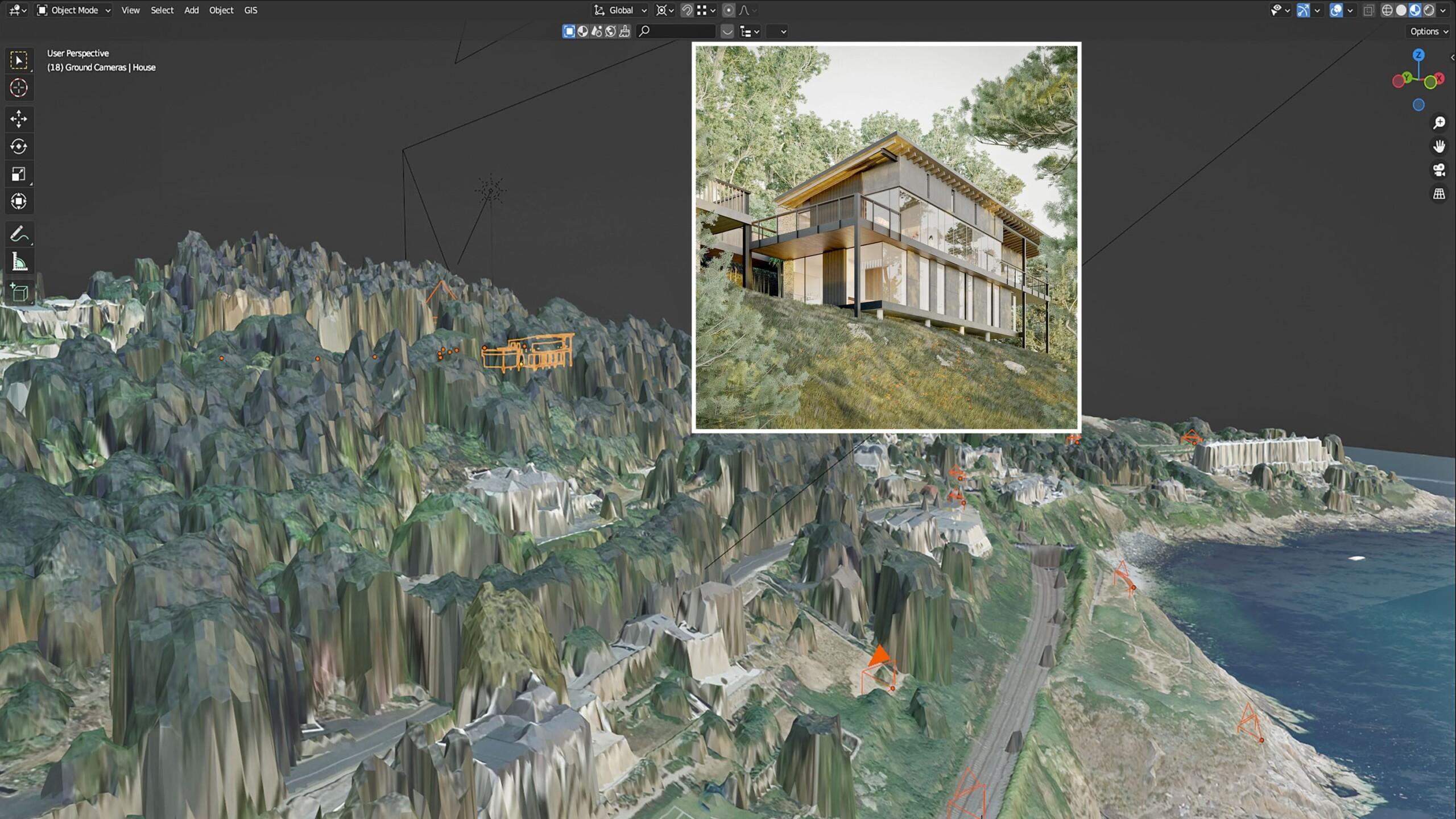
Bluesky LiDAR and Aerial Photography Bring Builds to Life for Dublin Design Studio
A Dublin based architectural consultancy is using data from aerial survey and mapping company Bluesky International to ensure the planning process is conducted as efficiently and smoothly as possible for…
Read More
January 2022
-
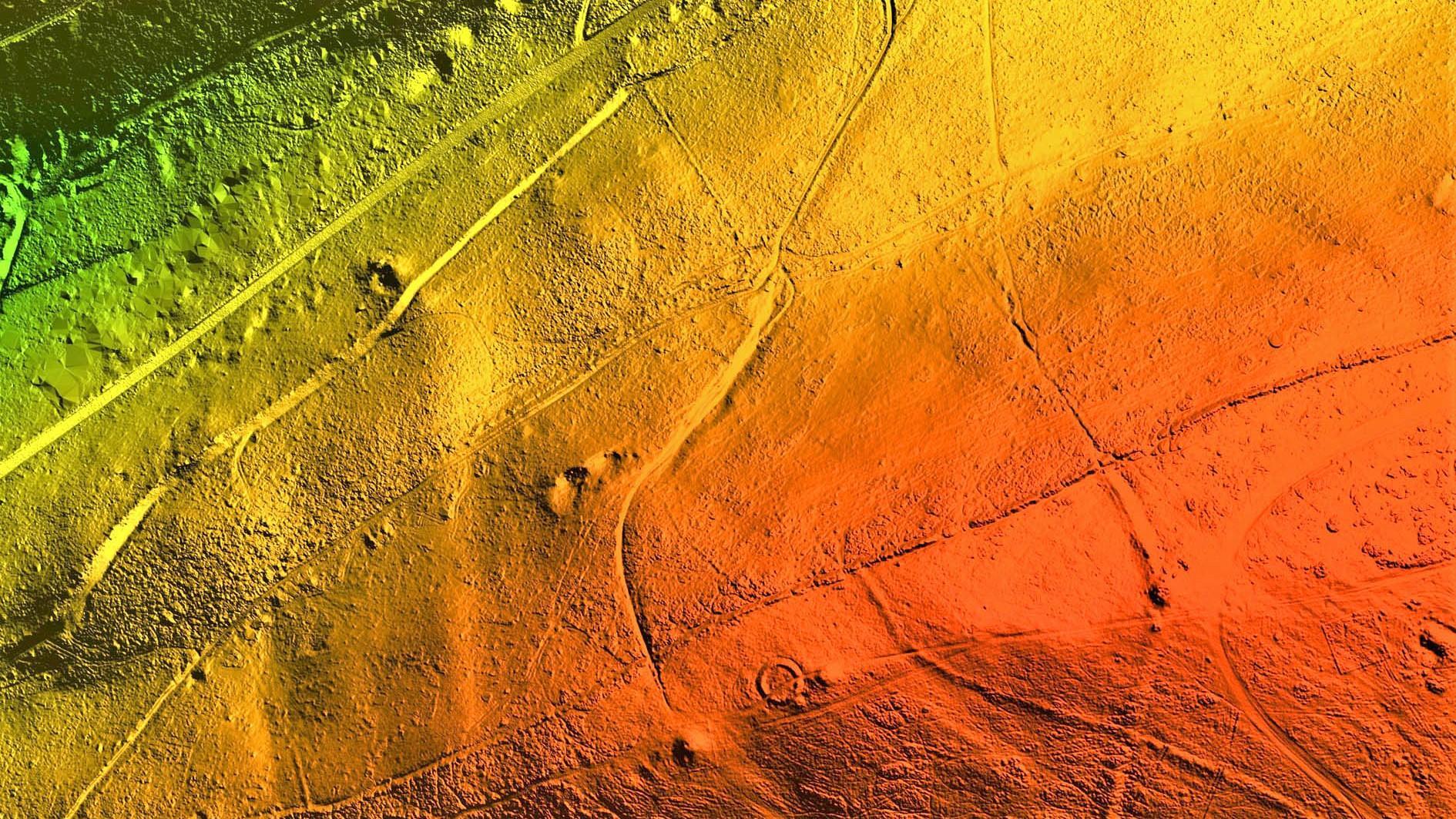
Bluesky International LiDAR Survey Reveals More than 400 ‘New’ Archaeological Sites in AONB
A high precision terrain mapping project has revealed more than 400 ‘new’ archaeological sites in England’s first Area of Outstanding Natural Beauty (AONB). Commissioned by the Quantock Landscape Partnership Scheme…
Read More
October 2021
-
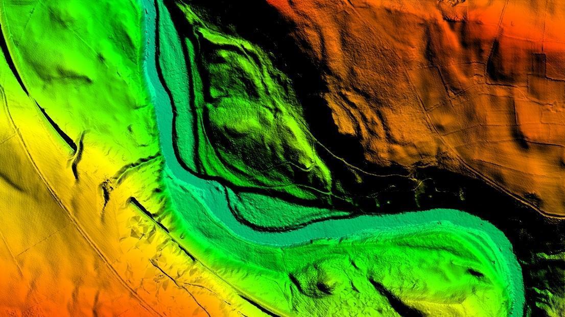
Bluesky LiDAR Benchmarks Carbon Neutral Farming in Northern Ireland
A European Innovation Partnership project to accelerate the move towards net carbon zero farming is using specially commissioned LiDAR data to create a baseline for future measurements. Working with ARCZero…
Read More
February 2021
-
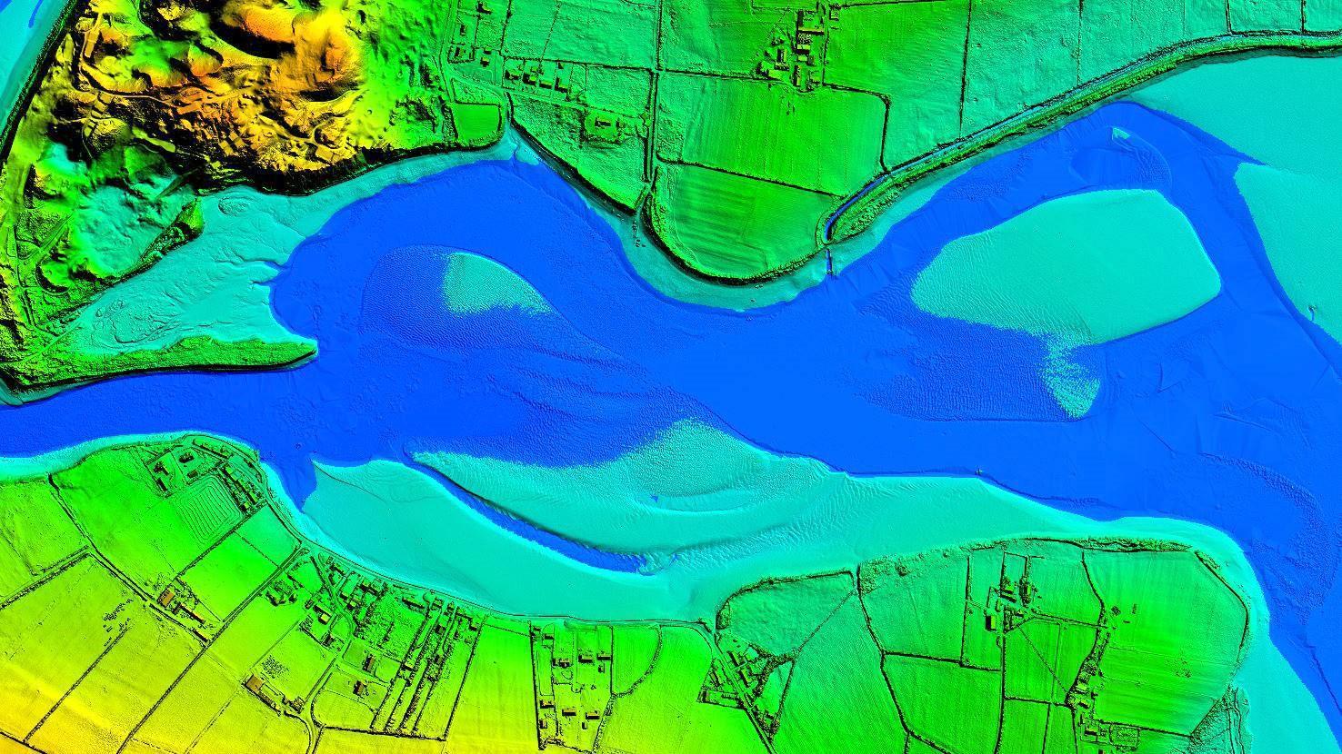
Bluesky International Takes to the Air to Create First Ever 3D Map of Northern Ireland’s Coastline
Bluesky International will use aircraft mounted LiDAR sensors laser scanners to create a highly detailed 3D map of the whole of the Northern Ireland coastline. Working on behalf of the…
Read More
January 2021
-
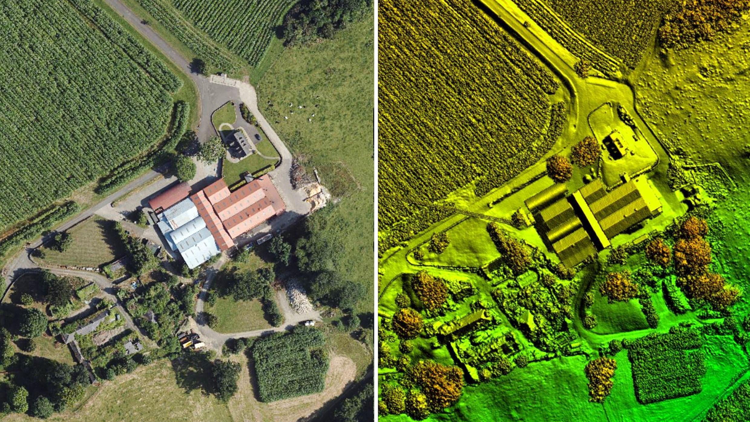
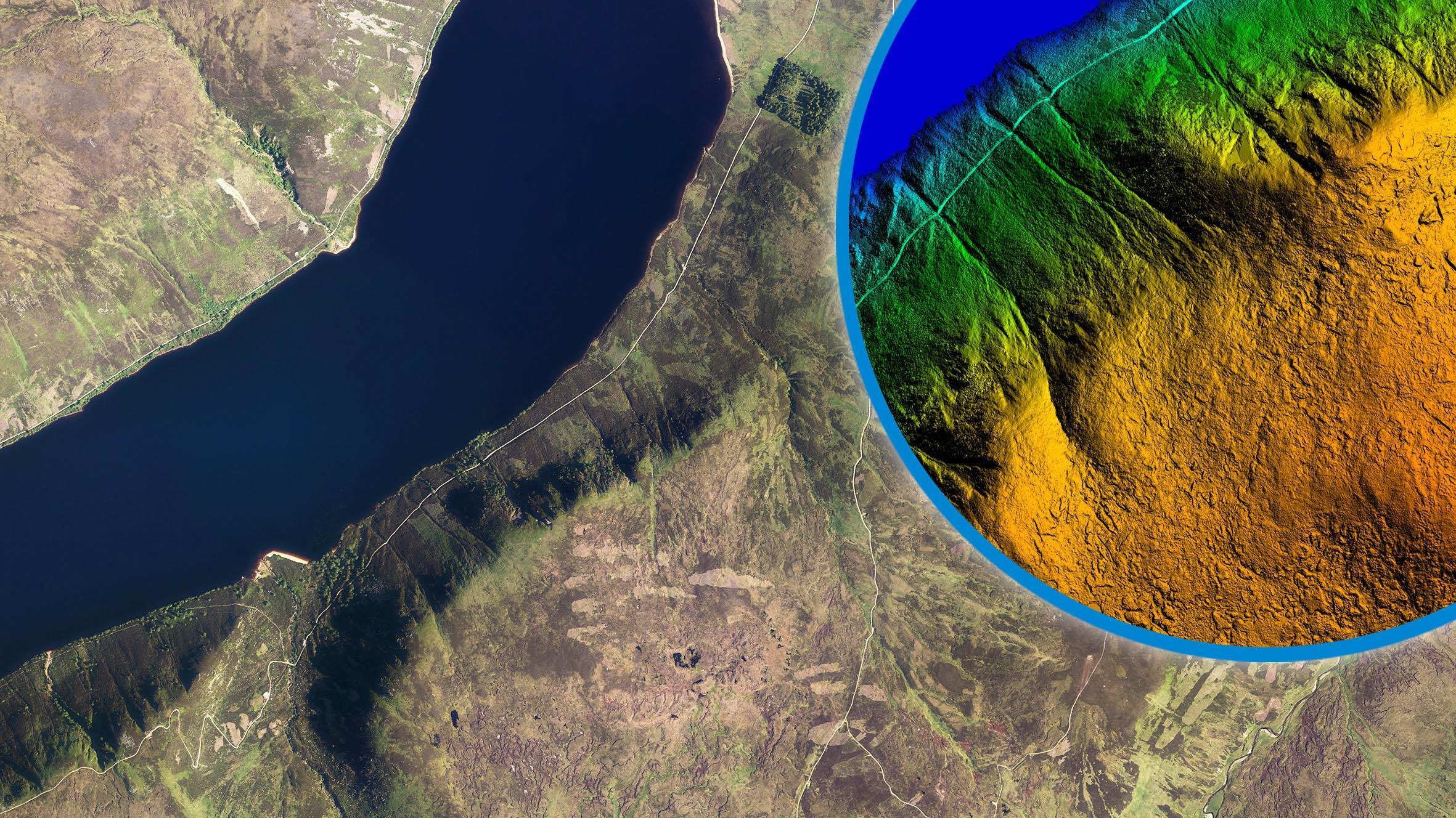
Bluesky International LiDAR Used to Visualise Peatland Restoration on Royal Estate
Data collected from survey aircraft equipped with advanced laser scanners is being used by the James Hutton Institute to monitor the natural restoration of land at the Queen’s Balmoral Estate…
Read More